
ၾၢႆႇ:USA New York City location map.svg

Size of this PNG preview of this SVG file: 634 × 600 ၽိၵ်ႉသႄႇလ်. resolutionsတၢင်ႇဢၼ် : 254 × 240 ၽိၵ်ႉသႄႇလ် | 507 × 480 ၽိၵ်ႉသႄႇလ် | 812 × 768 ၽိၵ်ႉသႄႇလ် | 1,082 × 1,024 ၽိၵ်ႉသႄႇလ် | 2,164 × 2,048 ၽိၵ်ႉသႄႇလ် ။
ၾၢႆႇငဝ်ႈတိုၼ်း (ၾၢႆႇ SVG, ၸိုဝ်ႈ 800 × 757 pixels, သႅၼ်းၾၢႆႇ : 418 KB)
ႁူဝ်ႁုပ်ႈ
| ၶေႃႈသပ်းလႅင်း |
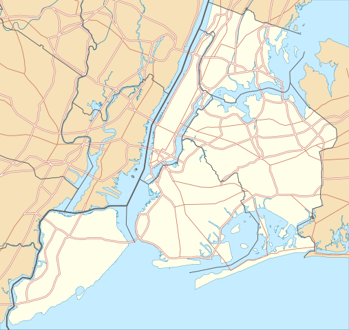
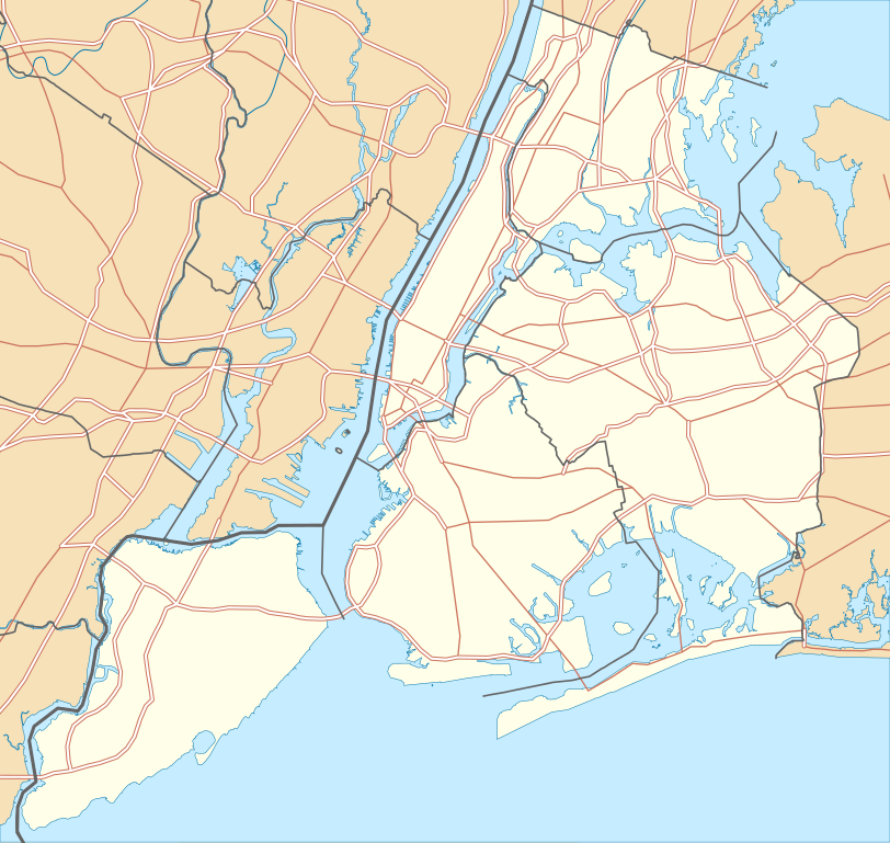
Quadratische Plattkarte, N-S-Streckung 130.0 %. Geographische Begrenzung der Karte:
Equirectangular projection, N/S stretching 130.0 %. Geographic limits of the map:
|
| ဝၼ်းထီႉ | |
| ငိူၼ်ႈငဝ်ႈတိုၼ်း |
ၵၢၼ်ၶွင်တူဝ်
|
| ၽူႈတႅမ်ႈလိၵ်ႈ | Alexrk2 |
| ၶေႃႈလူတ်းပွႆႇ (ၶိုၼ်းၸႂ်ႉ ၾၢႆႇဢၼ်ၼႆႉ) |
All OpenStreetMap data and maps are Creative Commons "CC-BY-SA 2.0" licensed |
| Other versions | Derivative works of this file: Panorama map.jpg |

|
This map has been made or improved in the German Kartenwerkstatt (Map Lab). You can propose maps to improve as well.
|
ဝ်ႂ
I, the copyright holder of this work, hereby publish it under the following licenses:

|
ပၼ်ၶႂၢင်ႉ တႃႇတေ ထုတ်ႇဢဝ်၊ ၽႄႈတိုၼ်း လႄႈ/ဢမ်ႇၼၼ် မႄးထတ်း ၼႂ်းလိၵ်ႈၼႆႉ ၸွမ်းၼင်ႇ ၶေႃႈမၼ်ႈၸႂ် GNU Free Documentation License, Version 1.2 ဢမ်ႇၼၼ် ၸိူဝ်းပဵၼ် မၢႆဢွၵ်ႇ ဢၼ်ထုၵ်ႇပိုၼ်ဢွၵ်ႇ ဝၢႆးလင် ၼင်ႇ Free Software Foundation; ဢၼ်ဢမ်ႇမီး လွင်ႈလႅၵ်ႈလၢႆႈ ၵႃႈတီႈ တွၼ်ႈၵၼ်၊ လိၵ်ႈၸိူဝ်းမီးတီႈ ၼႃႈသိုဝ်ႈၽၢႆႈၼႃႈ၊ ၼႃႈသိုဝ်ႈၽၢႆႇလင်။ဢၼ်ပဵၼ် ဝႂ်တႃႇထုတ်ႇဢဝ်ၼႆႉ မၼ်းတေၶဝ်ႈပႃးဝႆႉ ၵႃႈတီႈ တွၼ်ႈၵၼ် ဢၼ်မီးႁူဝ်ၶေႃႈဝႃႈ GNU Free Documentation License ၼၼ်ႉ။ |
This file is licensed under the Creative Commons Attribution 3.0 Unported license.
- ၸဝ်ႈၵဝ်ႇထၢင်ႇႁၢင်ႈ
- တႃႇၽႄၸႂ်ႉ – တွၼ်ႈတႃႇထုတ်ႇဢဝ်၊ ပိုၼ်ၽႄႈ လႄႈ ပိုၼ်ဢွၵ်ႇပၼ် ၼႃႈၵၢၼ်။
- ၶိုၼ်းထႅမ်သႂ်ႇ – မႄးထွင်ၵၢၼ် ႁႂ်ႈသၢင်ႇထုၵ်ႇ
- ၸွမ်းၼင်ႇ သၢႆႇငၢႆတီႈတႂ်ႈၼႆႉ
- ႁၢင်ႈၽၢင်ၶဝ်ႈပႃး – ၸဝ်ႈၵဝ်ႇတေလႆႈမွၵ်ႇပၼ်ၸိုဝ်ႈ ဢၼ်သၢင်ႇထုၵ်ႇ တွၼ်ႈတႃႇ ႁဵင်းၵွင်ႉ ဢၼ်ၵမ်ႉထႅမ်ပၼ် ဝႂ်ၶႂၢင်း လႄႈ သင်ၸိူဝ်ႉဝႃႈ လႆႈမီးလွင်ႈလႅၵ်ႈလၢႆႈမႃးၼႆ ၶႅၼ်းတေႃႈ ၸီႉၼႄပၼ်သေၵမ်း။ ၸဝ်ႈၵဝ်ထုၵ်ႇလီႁဵတ်း ႁႂ်ႈပဵၼ်တၢင်းႁဵတ်းသၢင်ႈ မီးလွင်ႈမီးတၢင်းမၼ်း၊ ၵူၺ်းၵႃႈဝႃႈ မၼ်းဢမ်ႇမၢႆထိုင်ဝႃႈ ဝႂ်ၶႂၢင်းၼၼ်ႉ မၼ်းတေပဵၼ် ဢၼ်ၸွႆႈဢၼ်ၵမ်ႉထႅမ်ပၼ် ၸဝ်ႈၵဝ်ႇ ဢမ်ႇၼၼ် ဢၼ်ၸဝ်ႈၵဝ်ႇၸႂ်ႉဝႆႉၼၼ်ႉ။
ၸဝ်ႈၵဝ်ႇထုၵ်ႇလိူၵ်ႈ ဝႆတွၼ်ႈတႃႇ ဢၼ်ၸဝ်ႈၵဝ်ႇလိူၵ်ႈၼၼ်ႉ
ပိုၼ်းၾၢႆႇ
တဵၵ်းၼိူဝ် ဝၼ်းထိ/ၶၢဝ်းယၢမ်း တႃႇႁၼ်ၾၢႆႇ ၼႂ်းဝၼ်းၼၼ်ႉ
| ဝၼ်းထီႉ/ၶၢဝ်းယၢမ်း | ႁၢင်ႈလဵၵ်ႉ | သႅၼ်းမၼ်း | ၽူႈၸႂ်ႉတိုဝ်း | တၢင်းႁၼ်ထိုင် | |
|---|---|---|---|---|---|
| ယၢမ်းလဵဝ် | 22:57, 2 ၸၼ်ႇဝႃႇရီႇ 2010 | | 800 × 757 (418 KB) | Alexrk2 | roads under boundaries |
| 22:54, 2 ၸၼ်ႇဝႃႇရီႇ 2010 |  | 800 × 757 (418 KB) | Alexrk2 | changed road signature | |
| 13:25, 2 ၸၼ်ႇဝႃႇရီႇ 2010 |  | 800 × 757 (482 KB) | Alexrk2 | == {{int:filedesc}} == {{Information |Description= {{de|Positionskarte von New York City, USA}} Quadratische Plattkarte, N-S-Streckung 130.0 %. Geographische Begrenzung der Karte: * N: 40.92° N * S: 40.49° N * W: 74.27� |
လွင်ႈၸႂ်ႉတိုဝ်း ၾၢႆႇ
4 ၼႃႈလိၵ်ႈ ၵွင်ႉမႃးၸူးၾၢႆႇၼႆႉ:
လွင်ႈၸႂ်ႉတိုဝ်းၾၢႆႇလူမ်ႈၽႃႉ
Wikis ၸိူဝ်းဢၼ်ၸႂ်ႉဝႆႉ ၾၢႆႇဢၼ်ၼႆႉ:
- ၸႂ်ႉဝႆႉ als.wikipedia.org
- ၸႂ်ႉဝႆႉ ar.wikipedia.org
- ၸႂ်ႉဝႆႉ arz.wikipedia.org
- ၸႂ်ႉဝႆႉ ast.wikipedia.org
- ၸႂ်ႉဝႆႉ az.wikipedia.org
- ၸႂ်ႉဝႆႉ ban.wikipedia.org
- ၸႂ်ႉဝႆႉ ba.wikipedia.org
- ၸႂ်ႉဝႆႉ be.wikipedia.org
- ၸႂ်ႉဝႆႉ bg.wikipedia.org
- ၸႂ်ႉဝႆႉ bh.wikipedia.org
- ၸႂ်ႉဝႆႉ bn.wikipedia.org
- টেমপ্লেট:তথ্যছক ঐতিহাসিক স্থান
- টেমপ্লেট:অবস্থান মানচিত্র মার্কিন যুক্তরাষ্ট্র নিউ ইয়র্ক সিটি
- অ্যাস্টোরিয়া, কুইন্স
- মেট্রোপলিটন মিউজিয়াম অব আর্ট
- ক্রাইসলার বিল্ডিং
- উলঅর্থ বিল্ডিং
- টেমপ্লেট:তথ্যছক ঐতিহাসিক স্থান/নথি
- মডিউল:অবস্থান মানচিত্র/উপাত্ত/মার্কিন যুক্তরাষ্ট্র নিউ ইয়র্ক শহর
- মডিউল:অবস্থান মানচিত্র/উপাত্ত/মার্কিন যুক্তরাষ্ট্র নিউ ইয়র্ক শহর/নথি
- ৮৬তম স্ট্রিট স্টেশন (সেকেন্ড অ্যাভিনিউ সাবওয়ে)
- ৯৬তম স্ট্রিট স্টেশন (সেকেন্ড অ্যাভিনিউ সাবওয়ে)
- লাগুয়ার্ডিয়া বিমানবন্দর
- ৫৭তম স্ট্রিট স্টেশন (আইএনডি সিক্সথ অ্যাভিনিউ লাইন)
- রুজভেল্ট আইল্যান্ড স্টেশন
- হিন্দু টেম্পল সোসাইটি অফ নর্থ আমেরিকা
- ৮৬তম স্ট্রিট স্টেশন (বিএমটি ফোর্থ অ্যাভিনিউ লাইন)
- ৯৬তম স্ট্রিট স্টেশন (আইআরটি ব্রডওয়ে–সেভেনথ অ্যাভিনিউ লাইন)
- ၸႂ်ႉဝႆႉ ca.wikipedia.org
- ၸႂ်ႉဝႆႉ ceb.wikipedia.org
တူၺ်း ၾၢႆႇmore global usage ဢၼ်ၼႆႉ