
ၾၢႆႇ:Thailand Bueng Kan locator map.svg

Size of this PNG preview of this SVG file: 341 × 599 ၽိၵ်ႉသႄႇလ်. resolutionsတၢင်ႇဢၼ် : 136 × 240 ၽိၵ်ႉသႄႇလ် | 273 × 480 ၽိၵ်ႉသႄႇလ် | 437 × 768 ၽိၵ်ႉသႄႇလ် | 582 × 1,024 ၽိၵ်ႉသႄႇလ် | 1,165 × 2,048 ၽိၵ်ႉသႄႇလ် | 1,052 × 1,849 ၽိၵ်ႉသႄႇလ် ။
ၾၢႆႇငဝ်ႈတိုၼ်း (ၾၢႆႇ SVG, ၸိုဝ်ႈ 1,052 × 1,849 pixels, သႅၼ်းၾၢႆႇ : 1.84 MB)
| ၶေႃႈသပ်းလႅင်း |
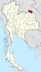
Deutsch: Lagekarte der Provinz Bueng Kan, Thailand English: Locator map of Bueng Kan Province, Thailand |
| ဝၼ်းထီႉ | (UTC) |
| ငိူၼ်ႈငဝ်ႈတိုၼ်း | |
| ၽူႈတႅမ်ႈလိၵ်ႈ |
|
| This is a retouched picture, which means that it has been digitally altered from its original version. Modifications: Merged together to show Bueng Kan province. The original can be viewed here: Amphoe Nong Khai.svg:
|
ၾၢႆႇဢၼ်ၼႆႉၼႆႉ မီးသုၼ်ႇဝႂ် ပႃႈတႂ်ႈ ၶွင် Creative Commons Attribution-Share Alike 3.0 Unported ဝႆႉၼႆႉ။
- ၸဝ်ႈၵဝ်ႇထၢင်ႇႁၢင်ႈ
- တႃႇၽႄၸႂ်ႉ – တွၼ်ႈတႃႇထုတ်ႇဢဝ်၊ ပိုၼ်ၽႄႈ လႄႈ ပိုၼ်ဢွၵ်ႇပၼ် ၼႃႈၵၢၼ်။
- ၶိုၼ်းထႅမ်သႂ်ႇ – မႄးထွင်ၵၢၼ် ႁႂ်ႈသၢင်ႇထုၵ်ႇ
- ၸွမ်းၼင်ႇ သၢႆႇငၢႆတီႈတႂ်ႈၼႆႉ
- ႁၢင်ႈၽၢင်ၶဝ်ႈပႃး – ၸဝ်ႈၵဝ်ႇတေလႆႈမွၵ်ႇပၼ်ၸိုဝ်ႈ ဢၼ်သၢင်ႇထုၵ်ႇ တွၼ်ႈတႃႇ ႁဵင်းၵွင်ႉ ဢၼ်ၵမ်ႉထႅမ်ပၼ် ဝႂ်ၶႂၢင်း လႄႈ သင်ၸိူဝ်ႉဝႃႈ လႆႈမီးလွင်ႈလႅၵ်ႈလၢႆႈမႃးၼႆ ၶႅၼ်းတေႃႈ ၸီႉၼႄပၼ်သေၵမ်း။ ၸဝ်ႈၵဝ်ထုၵ်ႇလီႁဵတ်း ႁႂ်ႈပဵၼ်တၢင်းႁဵတ်းသၢင်ႈ မီးလွင်ႈမီးတၢင်းမၼ်း၊ ၵူၺ်းၵႃႈဝႃႈ မၼ်းဢမ်ႇမၢႆထိုင်ဝႃႈ ဝႂ်ၶႂၢင်းၼၼ်ႉ မၼ်းတေပဵၼ် ဢၼ်ၸွႆႈဢၼ်ၵမ်ႉထႅမ်ပၼ် ၸဝ်ႈၵဝ်ႇ ဢမ်ႇၼၼ် ဢၼ်ၸဝ်ႈၵဝ်ႇၸႂ်ႉဝႆႉၼၼ်ႉ။
- သျေး ဢၼ်မိူၼ် – သင်ၸိူဝ်ႉဝႃႈ ၸဝ်ႈၵဝ်ႇ ၶိုၼ်းလေႃး၊ လႅၵ်ႈလၢႆႈ၊ မႄးၶိုၼ်း ဢမ်ႇၼၼ် ၵေႃႇသၢင်ႈ ၵႃႈတီႈၼိူဝ် ၼႃႈၵၢၼ်ၼႆႉၸိုင်၊ ၸဝ်ႈၵဝ်ႇ တေလႆႈဢဝ် လွင်ႈၸွႆႈသၢင်ႈၸဝ်ႈၵဝ်ႇၼႆႉ ပိုၼ်ၽႄႈ ၽၢႆႇတႂ်ႈ မိူၼ်ၼင်ႇ ဢမ်ႇၼၼ် ဝႂ်ငမ်ႇမႅၼ်ႈ ၼင်ႇ ငဝ်ႈတိုၼ်းမၼ်းၼၼ်ႉယဝ်ႉ။
Original upload log
This image is a derivative work of the following images:
- File:Thailand_Nong_Khai_locator_map.svg licensed with Cc-by-3.0, GFDL
- 2009-04-21T17:01:48Z NordNordWest 1052x1849 (1525269 Bytes) {{Information |Description= {{de|Lagekarte der Provinz Nong Khai, Thailand}} {{en|Locator map of Nong Khai Province, Thailand}} |Source=self-made, using * [[:file:Thailand location map.svg|Thailand location map.svg]] |Date=2
- File:Amphoe_Nong_Khai.svg licensed with Cc-by-sa-3.0
Uploaded with derivativeFX
ပိုၼ်းၾၢႆႇ
တဵၵ်းၼိူဝ် ဝၼ်းထိ/ၶၢဝ်းယၢမ်း တႃႇႁၼ်ၾၢႆႇ ၼႂ်းဝၼ်းၼၼ်ႉ
| ဝၼ်းထီႉ/ၶၢဝ်းယၢမ်း | ႁၢင်ႈလဵၵ်ႉ | သႅၼ်းမၼ်း | ၽူႈၸႂ်ႉတိုဝ်း | တၢင်းႁၼ်ထိုင် | |
|---|---|---|---|---|---|
| ယၢမ်းလဵဝ် | 21:27, 6 ဢေႃးၵၢတ်ႉ 2010 | | 1,052 × 1,849 (1.84 MB) | Ahoerstemeier | {{Information |Description={{de|Lagekarte der Provinz Nong Khai, Thailand}} {{en|Locator map of Nong Khai Province, Thailand}} {{en|1=Map of Nong Khai province, Thailand, with the districts (Amphoe) numbered. #Mueang Nong Khai (อำเภอเมื� |
လွင်ႈၸႂ်ႉတိုဝ်း ၾၢႆႇ
ၼႃႈလိၵ်ႈ ၵွင်ႉမႃးၸူးၾၢႆႇၼႆႉ:
လွင်ႈၸႂ်ႉတိုဝ်းၾၢႆႇလူမ်ႈၽႃႉ
Wikis ၸိူဝ်းဢၼ်ၸႂ်ႉဝႆႉ ၾၢႆႇဢၼ်ၼႆႉ:
- ၸႂ်ႉဝႆႉ ar.wikipedia.org
- ၸႂ်ႉဝႆႉ be.wikipedia.org
- ၸႂ်ႉဝႆႉ cdo.wikipedia.org
- ၸႂ်ႉဝႆႉ ckb.wikipedia.org
- ၸႂ်ႉဝႆႉ de.wikipedia.org
- ၸႂ်ႉဝႆႉ de.wikivoyage.org
- ၸႂ်ႉဝႆႉ en.wikipedia.org
- Bueng Khong Long district
- Bung Khla district
- Pak Khat district
- Si Wilai district
- Seka district
- So Phisai district
- Bueng Kan province
- Seals of the provinces of Thailand
- Template:BuengKan-geo-stub
- Si Wilai subdistrict
- Chumphu Phon
- Phon Charoen
- Tha Kok Daeng
- Seka subdistrict
- Bueng Khong Long subdistrict
- Dong Bang, Bueng Kan
- Pho Mak Khaeng
- Tha Dok Kham
- Bung Khla subdistrict
- Khok Kwang
- Nong Doen
- Pak Khat subdistrict
- Nong Yong
- Na Kang
- Na Dong
- Non Sila, Bueng Kan
- Som Sanuk
- Don Ya Nang
- Nong Hua Chang
- Pa Faek, Bueng Kan
- Si Chomphu, Phon Charoen
- Si Samran
- Wang Chomphu
- Ban Tong
- Nam Chan
- Nong Thum
- Pong Hai
- Sang, Bueng Kan
- Sok Kam
- Tha Sa-at
- Na Sabaeng
- Na Saeng, Bueng Kan
- Na Sing
တူၺ်း ၾၢႆႇmore global usage ဢၼ်ၼႆႉ