
ၾၢႆႇ:Vanuatu location map.svg

Size of this PNG preview of this SVG file: 324 × 599 ၽိၵ်ႉသႄႇလ်. resolutionsတၢင်ႇဢၼ် : 130 × 240 ၽိၵ်ႉသႄႇလ် | 259 × 480 ၽိၵ်ႉသႄႇလ် | 415 × 768 ၽိၵ်ႉသႄႇလ် | 553 × 1,024 ၽိၵ်ႉသႄႇလ် | 1,107 × 2,048 ၽိၵ်ႉသႄႇလ် | 625 × 1,156 ၽိၵ်ႉသႄႇလ် ။
ၾၢႆႇငဝ်ႈတိုၼ်း (ၾၢႆႇ SVG, ၸိုဝ်ႈ 625 × 1,156 pixels, သႅၼ်းၾၢႆႇ : 79 KB)
ႁူဝ်ႁုပ်ႈ
| Camera location | | View this and other nearby images on: OpenStreetMap |
|---|
| ၶေႃႈသပ်းလႅင်း |
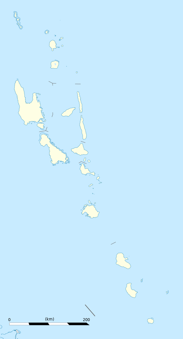
Equirectangular projection, WGS84 datum
Geographic limits of the map:
|
||
| ဝၼ်းထီႉ | |||
| ငိူၼ်ႈငဝ်ႈတိုၼ်း |
ၵၢၼ်ၶွင်တူဝ်
|
||
| ၽူႈတႅမ်ႈလိၵ်ႈ | Eric Gaba (Sting - fr:Sting) | ||
| ၶေႃႈလူတ်းပွႆႇ (ၶိုၼ်းၸႂ်ႉ ၾၢႆႇဢၼ်ၼႆႉ) |
|
||
| Other versions |
|

ဝ်ႂ
I, the copyright holder of this work, hereby publish it under the following licenses:
ၾၢႆႇဢၼ်ၼႆႉၼႆႉ မီးသုၼ်ႇဝႂ် ပႃႈတႂ်ႈ ၶွင် Creative Commons Attribution-Share Alike 3.0 Unported ဝႆႉၼႆႉ။
- ၸဝ်ႈၵဝ်ႇထၢင်ႇႁၢင်ႈ
- တႃႇၽႄၸႂ်ႉ – တွၼ်ႈတႃႇထုတ်ႇဢဝ်၊ ပိုၼ်ၽႄႈ လႄႈ ပိုၼ်ဢွၵ်ႇပၼ် ၼႃႈၵၢၼ်။
- ၶိုၼ်းထႅမ်သႂ်ႇ – မႄးထွင်ၵၢၼ် ႁႂ်ႈသၢင်ႇထုၵ်ႇ
- ၸွမ်းၼင်ႇ သၢႆႇငၢႆတီႈတႂ်ႈၼႆႉ
- ႁၢင်ႈၽၢင်ၶဝ်ႈပႃး – ၸဝ်ႈၵဝ်ႇတေလႆႈမွၵ်ႇပၼ်ၸိုဝ်ႈ ဢၼ်သၢင်ႇထုၵ်ႇ တွၼ်ႈတႃႇ ႁဵင်းၵွင်ႉ ဢၼ်ၵမ်ႉထႅမ်ပၼ် ဝႂ်ၶႂၢင်း လႄႈ သင်ၸိူဝ်ႉဝႃႈ လႆႈမီးလွင်ႈလႅၵ်ႈလၢႆႈမႃးၼႆ ၶႅၼ်းတေႃႈ ၸီႉၼႄပၼ်သေၵမ်း။ ၸဝ်ႈၵဝ်ထုၵ်ႇလီႁဵတ်း ႁႂ်ႈပဵၼ်တၢင်းႁဵတ်းသၢင်ႈ မီးလွင်ႈမီးတၢင်းမၼ်း၊ ၵူၺ်းၵႃႈဝႃႈ မၼ်းဢမ်ႇမၢႆထိုင်ဝႃႈ ဝႂ်ၶႂၢင်းၼၼ်ႉ မၼ်းတေပဵၼ် ဢၼ်ၸွႆႈဢၼ်ၵမ်ႉထႅမ်ပၼ် ၸဝ်ႈၵဝ်ႇ ဢမ်ႇၼၼ် ဢၼ်ၸဝ်ႈၵဝ်ႇၸႂ်ႉဝႆႉၼၼ်ႉ။
- သျေး ဢၼ်မိူၼ် – သင်ၸိူဝ်ႉဝႃႈ ၸဝ်ႈၵဝ်ႇ ၶိုၼ်းလေႃး၊ လႅၵ်ႈလၢႆႈ၊ မႄးၶိုၼ်း ဢမ်ႇၼၼ် ၵေႃႇသၢင်ႈ ၵႃႈတီႈၼိူဝ် ၼႃႈၵၢၼ်ၼႆႉၸိုင်၊ ၸဝ်ႈၵဝ်ႇ တေလႆႈဢဝ် လွင်ႈၸွႆႈသၢင်ႈၸဝ်ႈၵဝ်ႇၼႆႉ ပိုၼ်ၽႄႈ ၽၢႆႇတႂ်ႈ မိူၼ်ၼင်ႇ ဢမ်ႇၼၼ် ဝႂ်ငမ်ႇမႅၼ်ႈ ၼင်ႇ ငဝ်ႈတိုၼ်းမၼ်းၼၼ်ႉယဝ်ႉ။

|
ပၼ်ၶႂၢင်ႉ တႃႇတေ ထုတ်ႇဢဝ်၊ ၽႄႈတိုၼ်း လႄႈ/ဢမ်ႇၼၼ် မႄးထတ်း ၼႂ်းလိၵ်ႈၼႆႉ ၸွမ်းၼင်ႇ ၶေႃႈမၼ်ႈၸႂ် GNU Free Documentation License, Version 1.2 ဢမ်ႇၼၼ် ၸိူဝ်းပဵၼ် မၢႆဢွၵ်ႇ ဢၼ်ထုၵ်ႇပိုၼ်ဢွၵ်ႇ ဝၢႆးလင် ၼင်ႇ Free Software Foundation; ဢၼ်ဢမ်ႇမီး လွင်ႈလႅၵ်ႈလၢႆႈ ၵႃႈတီႈ တွၼ်ႈၵၼ်၊ လိၵ်ႈၸိူဝ်းမီးတီႈ ၼႃႈသိုဝ်ႈၽၢႆႈၼႃႈ၊ ၼႃႈသိုဝ်ႈၽၢႆႇလင်။ဢၼ်ပဵၼ် ဝႂ်တႃႇထုတ်ႇဢဝ်ၼႆႉ မၼ်းတေၶဝ်ႈပႃးဝႆႉ ၵႃႈတီႈ တွၼ်ႈၵၼ် ဢၼ်မီးႁူဝ်ၶေႃႈဝႃႈ GNU Free Documentation License ၼၼ်ႉ။ |
ၸဝ်ႈၵဝ်ႇထုၵ်ႇလိူၵ်ႈ ဝႆတွၼ်ႈတႃႇ ဢၼ်ၸဝ်ႈၵဝ်ႇလိူၵ်ႈၼၼ်ႉ
ပိုၼ်းၾၢႆႇ
တဵၵ်းၼိူဝ် ဝၼ်းထိ/ၶၢဝ်းယၢမ်း တႃႇႁၼ်ၾၢႆႇ ၼႂ်းဝၼ်းၼၼ်ႉ
| ဝၼ်းထီႉ/ၶၢဝ်းယၢမ်း | ႁၢင်ႈလဵၵ်ႉ | သႅၼ်းမၼ်း | ၽူႈၸႂ်ႉတိုဝ်း | တၢင်းႁၼ်ထိုင် | |
|---|---|---|---|---|---|
| ယၢမ်းလဵဝ် | 19:02, 21 ဢွၵ်ႇထူဝ်ႇပႃႇ 2013 | | 625 × 1,156 (79 KB) | TUBS | +provincial seaborders and matching int'l maritime borders |
| 22:12, 21 ၸၼ်ႇဝႃႇရီႇ 2009 |  | 625 × 1,156 (134 KB) | Sting | == Summary == {{Location|16|42|00|S|168|24|00|E|scale:3000000}} <br/> {{Information |Description={{en|Blank administrative map of Vanuatu in Oceania, for geo-location purposes.}} {{fr|Carte administrative vierge de [[:fr:Va |
လွင်ႈၸႂ်ႉတိုဝ်း ၾၢႆႇ
ဢမ်ႇမီးၼႃႈလိၵ်ႈဢၼ်ၵွင်ႉၸူး ၾၢႆႇဢၼ်ၼႆႉ
လွင်ႈၸႂ်ႉတိုဝ်းၾၢႆႇလူမ်ႈၽႃႉ
Wikis ၸိူဝ်းဢၼ်ၸႂ်ႉဝႆႉ ၾၢႆႇဢၼ်ၼႆႉ:
- ၸႂ်ႉဝႆႉ af.wikipedia.org
- ၸႂ်ႉဝႆႉ an.wikipedia.org
- ၸႂ်ႉဝႆႉ ar.wikipedia.org
- ၸႂ်ႉဝႆႉ ast.wikipedia.org
- Puertu Villa
- Módulu:Mapa de llocalización/datos/Vanuatu
- Módulu:Mapa de llocalización/datos/Vanuatu/usu
- Aeropuertu Internacional Bauerfield
- Aeropuertu Internacional de Santo-Pekoa
- Malakula
- Aore
- Luganville (Vanuatu)
- Monte Tabwemasana
- Maewo
- Erromango
- Islla de Pentecostés
- Aneityum
- Vanua Lava
- Islla Epi
- Ambae
- Gaua
- Efate
- Islla Espíritu Santo (Vanuatu)
- Ambrym
- Islla Tanna
- ၸႂ်ႉဝႆႉ az.wikipedia.org
- ၸႂ်ႉဝႆႉ ba.wikipedia.org
- ၸႂ်ႉဝႆႉ be-tarask.wikipedia.org
- ၸႂ်ႉဝႆႉ be.wikipedia.org
- ၸႂ်ႉဝႆႉ bg.wikipedia.org
- ၸႂ်ႉဝႆႉ bn.wikipedia.org
- ၸႂ်ႉဝႆႉ bs.wikipedia.org
- ၸႂ်ႉဝႆႉ ceb.wikipedia.org
တူၺ်း ၾၢႆႇmore global usage ဢၼ်ၼႆႉ