တီႇယေးၵူဝ်း ၵရႃႇသီးယႃး
Appearance
 Aerial photograph of Diego Garcia | |
| ပထဝီႇ | |
|---|---|
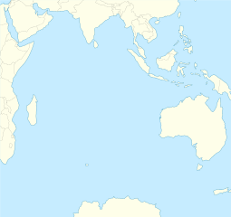
| ၵူဝ်ႇဢေႃးတိၼဵတ်ႉ | 7°18′48″S 72°24′40″E / 7.31333°S 72.41111°Eၵူဝ်ႇဢေႃးတိၼဵတ်ႉ: 7°18′48″S 72°24′40″E / 7.31333°S 72.41111°E |
| မူႇၵုၼ် | Chagos Archipelago |
| ၼမ်ႉဢၼ်ဢိူမ်ႈဝႆႉ | Indian Ocean |
| လွင်ႈၽွင်းငမ်း | |
| Demographics | |
| ႁူဝ်ၼပ်ႉၵူၼ်း | 4,239[1] |
| ၶေႃႈမုၼ်း တၢင်ႇၸိူဝ်း | |
| ၶၢဝ်းယၢမ်းၼႃႈလိၼ် | |
| Designated | 4 July 2001 |
| Reference no. | 1077[2] |
ၽိုၼ်ဢိင်
[မႄးထတ်း | မႄးထတ်းငဝ်ႈငႃႇ]- ↑ Country Profile: British Indian Ocean Territory (British Overseas Territory). Foreign and Commonwealth Office (12 April 2012). Archived from the original on 20 June 2012။ Retrieved on 21 June 2012။
- ↑ Diego Garcia. Retrieved on 25 April 2018။

